Here is the 3rd and final entry of
A Road Less Traveled, my blog series detailing my summer roadtrip along California's scenic remote HWY 33. If you have not already, now would be a great time to read the
first and
second posts!
Here is a refresh of my complete Berkeley-Santa Barbara route:
 |
Route Overview - 367 miles/590 kM
|
 |
| Hwy 33 through Coalinga |
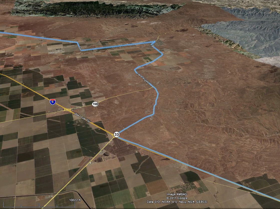
I exited Interstate 5 and headed south on California Highway 33. This area is quite desolate and has a lonely feel, and the sun was beaming down furiously. The highway meanders south/southwest for about ten miles before arriving at the town of with Coalinga, CA. Like many of the towns out here, Coalinga was once populated with workers servicing the area's plentiful oil fields. Unfortunately, drilling production declines and increasing mechanization mean fewer jobs, and thus fewer residents.
 |
| Southbound HWY 33 |
 |
| HWY 33 through Coalinga - repaving in progress! |
After leaving Coalinga, the 33 parallels Interstate 5 along the western edge of the Central Valley. The rolling hills flatten out, and the terrain becomes desolate. Not much exists aside from the thin ribbon of pavement.
 |
| Following Hwy 33 parallel to I-5 |
 |
| Looking down the 33 |
 |
| And the view to the side of the road. Hey look! A fence! |
Taft remains one of the largest towns on the old Hwy 33, although it clearly appears to be far past it's prime. The Highway ran along the edge of the downtown, and revealed mostly closed storefronts and dark windows. The old movie theater was barren and forgotten with a unenthusiastic greeting scrawled on its marque.
 |
| Fox Theater in Taft, CA |
 |
| Taft (lower right hand corner) and Maricopa |
After Taft, Hwy 33 intersects with Hwy 166 in Maricopa, CA. Maricopa is a shell of a town which makes Taft look it a thriving metropolis.
 |
| Hwy 33 joins Hwy 166 near Maricopa |
 |
| Winding up Hwy 33/Hwy 166 into the Cayuma Valley |
 |
| South towards Pine Mountain. Ojai and Ventura are directly over the mountain. |
 |
| Upper Cayuma Valley. |
 |
| Climbing the North Face of Pine Mountain in the rugged California Traverse Range |
 |
| Pine Mountain Sattle, Hwy 33, with ridge access roads. |
After climbing up the New Cayuma valley and cresting the Traverse Range, Hwy 33 pops out and winds down into the coastal valleys of Ojai, CA. At the summit at Pine Mountain, two small roads (on on either side) provide access to exciting trails and outlooks along the ridge!
 |
| Across the high, dry Sespe River Valley |
 |
| Winding down the mountain into Ojai |
 |
| Through Ojai to Hwy 150 |
 |
| Back to 101 and my destination of Santa Barbara! |
 |
| Speed and Elevation Profile |
More pics to follow!


No comments:
Post a Comment
Note: Only a member of this blog may post a comment.