31 January 2011

My First Geocacheing Adventure - More Mesa

Yesterday began my foray into the wild world of geocacheing! For those of you who haven't heard of it, geocacheing is a hobby where one places a small container in a well-hidden public place, marks the location w/ one's GPS, and posts it online for others to find. Typical 'caches' include a logbook to register one's visit, and a variety of small trinkets meant to be traded by cache visitors. You should sign the logbook, and feel free to take and leave trinkets for others to find. It's like a long-term world-wide treasure hunt!

For my geocache, I went out to More Mesa in Santa Barbara. This Mesa is a large section of coastal open space, and has breathtaking views of the oceans and mountains. I found the caches I would look for on geocaching.com. I would highly recommended making an account there; it's free, and allows you to access all sorts of info on the various caches. You can see who has been there, and what comments they've posted about the condition of the cache, etc.

Our Route on More Mesa (looking N-NW)
We started at the sourthern end of Patterson Road in Goleta, and walked down to the trailhead for More Mesa. We spent a delightful afternoon of sun and rain criss-crossing the mesa, trying to find all the geocaches we had marked out ahead of time.

I have a Garmin Oregon 450t, and I was able to load geocache information directly from geocacheing.com to my handheld device! Very cool!

Our Blue Tracks in the greater Santa Barbara region


The Caches we set out to find!

Parking info!


Results: We found green pins, couldn't find red pins, and yellow are general information.
Caches generally contained a variety of small items in a waterproof container. Most are hidden within feet of major trails, but are hidden so as to be invisible unless you know where to look.

Over, this was a very fun experiment! Next time I would like to bring my trinkets to leave in caches, and also I will bring a camera and a notebook. I need to take more comprehensive notes on cache condition and contents to post it here. Also, I learned a lot about how to property use my GPS device for geocaching. It has a lot to offer, but is very complicated!

Files to download

29 January 2011

Visit San Francisco virtually! Bay Area now in 3D on Google Earth

On Thursday, Jan 27th, Google rolled out tons of new 3D features across the bay area in Google Earth. Some of the improvements include buildings, topography, famous landmarks, geographic features, etc! This is a cool way to get to visit the bay area without having actually been there.


Check out this cool 3D flyover from Google:


The GooglePlex in Mountain View, CA


Looking North over Hwy 1 at the Golden Gate Bridge and Marin County


UC Berkeley Campus


To make this work, be sure to install the Google Maps Plugin for Google Earth.
For More info, Check out the Google Earth Blog.


28 January 2011

You Plan SB: A Shining Example of Urban Planning

Today in my Urban Planning class at UCSB, we heard a lecture from Mr. John Ledbetter regarding the master growth plan for Santa Barbara. For the past fifteen years, Ledbetter has worked for You Plan Santa Barbara, an organization works with the community to develop and implement the SB General Plan.

The Santa Barbara Waterfront and Sterns Wharf

Mission Santa Barbara

Over the past twenty years, You Plan SB has worked with all residents to maintain Santa Barbara's charm, earning the city the moniker "American Riviera" and keeping it a desirable place to live, work, and play. The General Plan has limited commercial and residential sprawl considerably over the past twenty years by encouraging redevelopment of the central business district to achieve dense, mixed commercial and residential use. Dense growth is facilitated by the efficient street layout; despite being old and narrow, Santa Barbara's streets form a grid pattern which greatly eases traffic flow. It also makes an ideal environment for walking and  public transit. 

Downtown Santa Barbara


Geographic Information Systems (GIS) are essential to any type of urban planning. You Plan Santa Barbara has a wide variety of data available via maps, including land type, zoning, flood and fire risk areas, utilities, and public transit.

GIS map of level of urban noise in downtown Santa Barbara

Watersheds and drainage: important to understand potential
landslides in mountainous areas and flooding near the coast.
Want to learn more or get involved? You Plan SB has a great website for the public to learn about the project and to find out how to submit their comments, as residents' feedback has been essential for this whole project. Also available are all sorts of maps (like those pictured above) and documents which outline the plan in great detail.

26 January 2011

China Camp State Park: A Little Corner of Paradise

China Camp State Park is located near my hometown of Novato, in Marin County, CA. It is a beautful spead of bayside open space complete with marshes, hills, trees, trails for hiking and biking, and beautiful views of San Francisco and the bay area. Although only 25 minutes north of San Francisco, China Camp feels like a trip back to a more simple time in California's past.

China Camp is located on the eastern coast of Marin County, on the northern most reaches of the San Francisco Bay.


 This route forms a loop, connecting to highway 101 at both ends. Technically only a small portion of this route goes through the state park, but my friends and I refer to the whole drive as the 'China camp loop.' You can go either way on the drive, or do both ways to catch all the sights!


A view of the coast along San Francisco Bay. The waterfront marshland in this picture  is marked in the photo below.


Three points of reference in the area.

China Camp State Park sits on what was a fishing village populated primarily by Chinese migrants. At its heyday, it had around 500 residents and several general stores. The area is now preserved as a state park and makes an outdoor enthusiast's paradise. If you ever find yourself in Marin County, don't forget to stop by and check it out.


 Expect a slow, winding drive!! Small cars are more fun than big in this case. In a Honda Civic, I averaged around 18 KPH


 A few of the remaining structures of China Camp.

The section of road outlined in red in the main stretch of China camp State Park. Lots of parking, trail heads and beach access are available along this stretch.

The red section of road here runs mainly through populated areas. Great views of San Francisco over the water!


25 January 2011

No Place like home? Just ask your GPS!

Using a GPS receiver is a fun way to add another layer of excitement to any journey or adventure. Should your GPS unit ever fall into the hands of an unscrupulous pick-pocket, however, you may have just given away the keys to the kingdom. When I set up my Garmin receiver, it allowed me to designate a 'home' point to navigate back to at the end of the trip. This seemed convenient, so I started adding waypoints all throughout my day. Than I realized that anyone who gained access to my device would know everywhere I was, when I was there, for how long, etc. It just did not seem prudent to have things placeholders for things like home, parents house, and secret buried treasure. This hypothetical person who just stole your GPS now knows where you and the rest of shiny gadgets live.


Is your GPS telling secrets about your life?


Don't forget about smartphones and tablets. This devices are often GPS enabled and if you carry one, it knows quite a bit about what you do, where you go, etc. Than again, some get a kick out of doing everything in public as we can tell from Foursquare, Gowalla, Facebook places, etc. Just be aware of what your device knows, and what it will tell if it's lost of stolen!


24 January 2011

Visit to Solvang


The other morning I woke up and wanted to get out and enjoy the sun! School has been super hard, and I wanted to show my little sister around seeing as she had just moved here. We left Santa Barbara going north on HWY 154, and turned off below the summit to go exploring in the mountains. After taking some pictures and soaking up the views, we drove on through to Solvang. Built in a traditional Tudor village style, Solvang is an adorable little community in the Santa Ynez which is known for its cafes, quaint public squares and 'far-away' feel. I would highly recommend a visit!


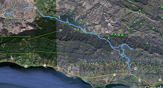
Here is the route we took to Solvang


Painted Cave Road(in red) is crazy steep! This is looking N-NW


Camino Cielo (in red) runs along the ridge of the Santa Ynez mountains, and offers breathtaking views of the coast and valley. Careful! It is very steep, and unpaved in sections.


Angeled picture to show topography - Hwy 154, Camino Ceilo Rd/Painted Cave Rd. 


When we finally got to Solvang, we parked and walked around. After some Danish and espresso, we hit the road back to SB


 The view from San Marcos Pass looking towards the ocean, with HWY 154 snaking up the mountains. Santa Barbara is in distance!


 Another angle of HWY 154 between Painted Cave Road and Camino Cielo, looking east.


Elevation/Speed Profile
Elevation is Red, Speed is Blue


Download the KML file here

21 January 2011

DGPS: can your GPS do this?

I stumbled accross a blog describing 'DGPS' and how it allows for improved accuracy. I was intrigued, and I discovered that in some countries, land-based UHF radio signals are broadcast to augment location accuracy. Appearently, these DGPS systems can achieve accuracy of .6 M about 100 kM from the broadcast location. Thats over open ocean mind you, but those numbers still boggled my mind. I'll have to find out more about how pervasive DGPS coverage is in different parts of the world.

demonstrating a DGPS fix.. accuracy of 2 M. Picture credit to GPS addiction

Also, check out the Wikipedia article for more info!


Here is a picture of a private DGPS station in Germany.
Original Image © User:bdk / Wikimedia Commons / CC-BY-SA-3.0

A battery operated GPS receiver used for 'precision agriculture' navigation. It calculates its position to a few minutes, and than sends out a DGPS correction signal via FM radio to GPS devices on nearby farm equipment. Any agriculturalists out there who know more about this?

20 January 2011

California spaceport bids bon voyage to huge rocket!

Today we watched with awe as the Delta IV Heavy launched just up the coast from Santa Barbara at Vandenberg AFB near Lompoc, CA. This rocket, one of the largest every launched in the US, is thought to have been carrying a government spy satellite capable of identifying vehicle makes and models from space. It was a spectacular view, and here are some maps of the area. Check out where the action is!

here we are about 75 miles north of LA. This unique section of CA's coast line runs East-West, resulting in over-land sun sets. 


Here we see the main campus of the AFB, on the northern outskirts of Lompoc, CA. the blue line in the image is a route i took on a drive a while ago!


A close-up of launch pad on Point Conception. It's about 10-15 miles from the main base.


Possible flight paths from this particular launch site. Couldn't find exactly which one was used today. If you're handy with a protractor and saw the launch, let me know what you think!

Increased GPS accuracy through cell signal!

This is a fascinating post from GPS-practice-and-fun.com which details the increasing blending of GSM technology with GPS to improve location accuracy. GSM, a cellular technology used worldwide, gives GSM enabled GPS devices a second network with which to perform location pings. If you device cannot get a precise GPS fix, it can cross reference available GSM signals to further triangulate your location. Very cool! Check out the original post for more detailed info.

GPS enabled devices are often less accurate than standalone GPS receivers!

19 January 2011

Bike Ride to School

Sometimes on these warm summer nights, I like to ride my bike up to campus. And since it's summer all year long here in Santa Barbara, I've been riding to and from quite a bit recently. I took the "coastal route" bike trail up through Goleta beach park and up onto the mesa into campus.

My Route:


Speed and Elevation
Its (literally) an uphill battle to campus! Riding back is a lot faster.

18 January 2011

Hello World!

The maiden Voyage of my Garmin Oregon 450t.

 The is a Google Earth image of the journey. 

This graph shows speed and elevation at any point in time or space. Blue is MPH, Red is elevation in feet.

Stats
Distance: 49.8 miles
Average speed: 25.3 mph

KML File for your perusal: drive01