
I am taking UCSB's Intro to Geology class this summer, and we just went on our field trip to observe geological formations in the Santa Ynez mountains. The trip really helped me understand the formation of rocks, mountains, and valleys; geology is a lot easier to understand when observing it in the field than learning about it in the classroom.
Our class piled into vans and went up Gibraltar Road, which begins in the foothills of Monticeto and winds its way up to the ridge of the mountains. Along the way we stopped several times to observe different layers of rock where they protruded from within the mountains. The Santa Ynez mountains are composed primarily of sandstone and shale. The sandstone is relatively hard and tends to form peaks, while the shale is softer and erodes more easily.
 |
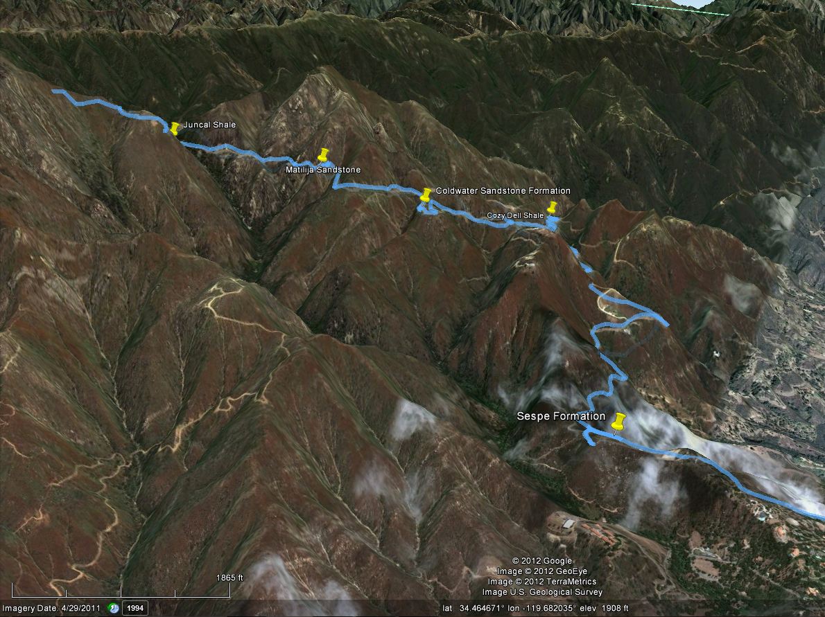
| An overview of our route. |
 |
| Route overview, including return trip. |
 |
| Speed/Elevation Profile: Speed is purple, and elevation is in red. |
The main formations we viewed, in the order we passed them, were:
- The Sespe Sandstone Formation - a reddish sandstone with lots of rocks and pebbles mixed in.
- The Cozy Dell Shale Formation - very soft shale which would crumble in one's hand.
- Coldwater Sandstone Formation - hard, durable rock which comprises the peaks of the Santa Ynez Mountain Range
- Matilija Sandstone - like the coldwater sandstone, but with more shale mixed in.
- Juncal Shale - Another bed of soft, crumbly shale.
route.JPG) |
| A view of our route looking north. |
 |
| A good outcropping of the bottom layers of Sespe formation was visible here. |
 |
| Cozy Dell Shale near the 'No Shooting' signs on Gibraltar road. |
The sandstone formations are much harder and therefore form the peaks of the mountains. Areas comprised of shale are soft and erode into valleys. These alternating bands of shale and sandstone help explain the formation of the moutain's topography.
 |
| View from the Coldwater Sandstone pin, looking west. |
We stopped to view the coldwater sandstone formation from a distance. The above image is the view we saw; notice how there are two peaks with a valley inbetween. The peaks are both comprised of sandstone while the valley is mostly shale.
 |
| Again, notice how the sandstone is perched on a ridge, while the shale is visible in the valley. |
 |
| The view from La Crumbre Peak, looking East. A good portion of our route is visible. |
Here is an interactive map of our route. If you zoom in, you can see areas where there appears to be lots of frantic running around. These areas are where we stopped and got out of the vans to walk around, and the GPS unit recorded my movements as I examined the rock formations!
View Larger Map
No comments:
Post a Comment
Note: Only a member of this blog may post a comment.